
My Cart
Your Shopping Cart is currently empty. Use Quick Order or Search to quickly add items to your order!
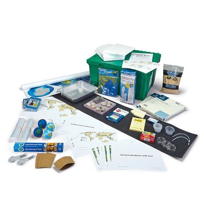

Grades 6–8. In this unit students answer the question, "What causes Earth's surface to change?" During hands-on investigations, students explore earthquakes, determine why mountains and landscapes change, and apply what they have learned to explain how a marine fossil was found near the top of a mountain. Kit includes basic teacher access to instructional materials on CarolinaScienceOnline.com, plus enough materials to teach 1 class of 32 students per day.
For additional program information and pricing, complete this form or contact your sales representative.
Grades 6–8. In Unit 6.4 Plate Tectonics and Rock Cycling, Carolina Certified Version*, students work to answer the Unit Driving Question: "What causes Earth's surface to change?"
Students are presented with the 2015 Himalayan earthquake at Mt. Everest that resulted in scientists from Nepal and China collaborating to determine what, if any, changes had occurred to Mt. Everest. Students find that Mt. Everest has grown in elevation over the years. Students also discover that Mt. Everest is steadily moving to the northeast every year. This leads to questions about whether changes are happening to other mountains in the world. Students analyze data from five other mountain peaks and their surroundings and find that some other mountains are also growing in elevation, while others are decreasing or not changing in elevation. Students brainstorm ideas for what could be causing these changes to mountains and create an initial consensus model to explain how mountains can move, grow, and shrink.
Using ideas brainstormed as potential causes of mountain changes, students begin by investigating earthquakes. Students analyze another location that has shifted vertically and horizontally during an earthquake and begin keeping track of whether events that happen are linked through causal or correlational relationships. The class discovers it gets hot enough underground to make hard solid rock shift and move, and they connect this with the long lines of earthquakes at different places on the world map to develop a profile model of North America from the Pacific to the middle of the Atlantic. Students analyze plate movement data and carry out investigations to model what could happen as these plates move and interact. Students conclude that plate movement is the cause of earthquakes and that earthquakes are correlated to mountains moving.
Over the course of the rest of the unit, students analyze data from many locations and time periods, applying the ideas of temporal and spatial scales accompanied by causal and correlational relationships to determine the reason why mountains and landscapes grow, move, and shrink. The unit ends with students using what they have figured out about uplift and erosion to explain how an exposed marine fossil was found near the top of Mt. Everest.
This unit supports students to:
This 1-Class Unit Kit includes basic teacher access to instructional materials on CarolinaScienceOnline.com, plus the materials needed to teach 1 class of 32 students per day.
Building Toward NGSS Performance Expectations
Science and Engineering Practices
The following practices are also key to the sensemaking in the unit:
Focal Disciplinary Core Ideas
Focal Crosscutting Concepts
The following crosscutting concept is also key to the sensemaking in the unit:
*All enhancements to materials and instruction for this Carolina Certified Version of the unit are approved by OpenSciEd to preserve the integrity of the storyline and the instructional model.
